- Published on
An Ambition Realized
- Author
-
-
- Name
- Posts
- Posts
-


Dong Van Karst Plateau Geopark
Like most writers and photographers, I have always seen National Geographic as the pinnacle of excellence for travel writing and images, so have often dreamed of seeing my work in their hallowed publications. A few years ago, out of the blue, I got that opportunity when they asked me to update the National Geographic Traveler Guide to Vietnam. And while that made me feel proud, I still longed to see an image of mine in a Nat Geo publication as well.
Now I've realized that ambition too, in the form of an image of a place that I have a great fondness for—the Dong Van Karst Plateau in Ha Giang Province, Vietnam. Ha Giang has always seemed special to me since I first worked on a Vietnam guidebook for Rough Guides in 2002. At the time there was no mention of this province, Vietnam's northernmost, in any of the guide books I used for reference, and admittedly it was tricky to travel there as the border with China was still sensitive after conflicts between the two countries from 1979 to 1990.
Anyway, I got the necessary permit, went there and wrote it up in glowing terms, as the place just blew me away. For nearly 2500 square kilometers, the landscapes are like the one above—ridge after ridge of magnificent karst erupting in the wildest shapes. In 2010, the area was designated Vietnam's first geopark, and helpful signboards were erected at key points, mostly where there are jaw-dropping views, giving explanations (though somewhat garbled!) of the geological processes at work.
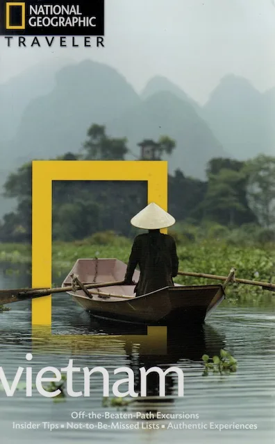
This image of the geopark will appear in the third edition of National Geographic Traveler Guide to Vietnam, which I have recently updated and is due to appear in 2015, so I hope you'll all rush out and buy (or stay home and download!) a copy! Incidentally, if any editors are reading who are on the look-out for a story on an off-beat destination that is bound to explode in popularity soon, please get in touch!
Anyway, I got the necessary permit, went there and wrote it up in glowing terms, as the place just blew me away. For nearly 2500 square kilometers, the landscapes are like the one above—ridge after ridge of magnificent karst erupting in the wildest shapes. In 2010, the area was designated Vietnam's first geopark, and helpful signboards were erected at key points, mostly where there are jaw-dropping views, giving explanations (though somewhat garbled!) of the geological processes at work.
This image of the geopark will appear in the third edition of National Geographic Traveler Guide to Vietnam, which I have recently updated and is due to appear in 2015, so I hope you'll all rush out and buy (or stay home and download!) a copy! Incidentally, if any editors are reading who are on the look-out for a story on an off-beat destination that is bound to explode in popularity soon, please get in touch!
National Geographic Traveler Guide to Vietnam, 2nd edition
0 Comments